Take a first look at the new standardized designs coming to Bay Area transit maps and signs
A new, uniform look for transit maps and signs in the Bay Area is almost here.
The new transit maps and signs are designed to make transit journeys easier to understand for existing and new riders by delivering information that is clear, predictable, and familiar across service areas and county lines.
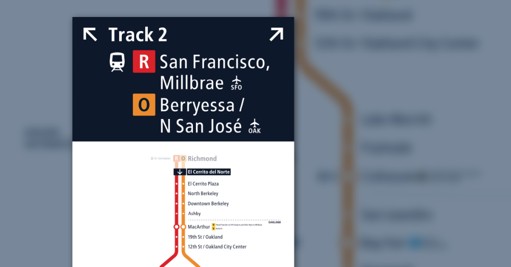
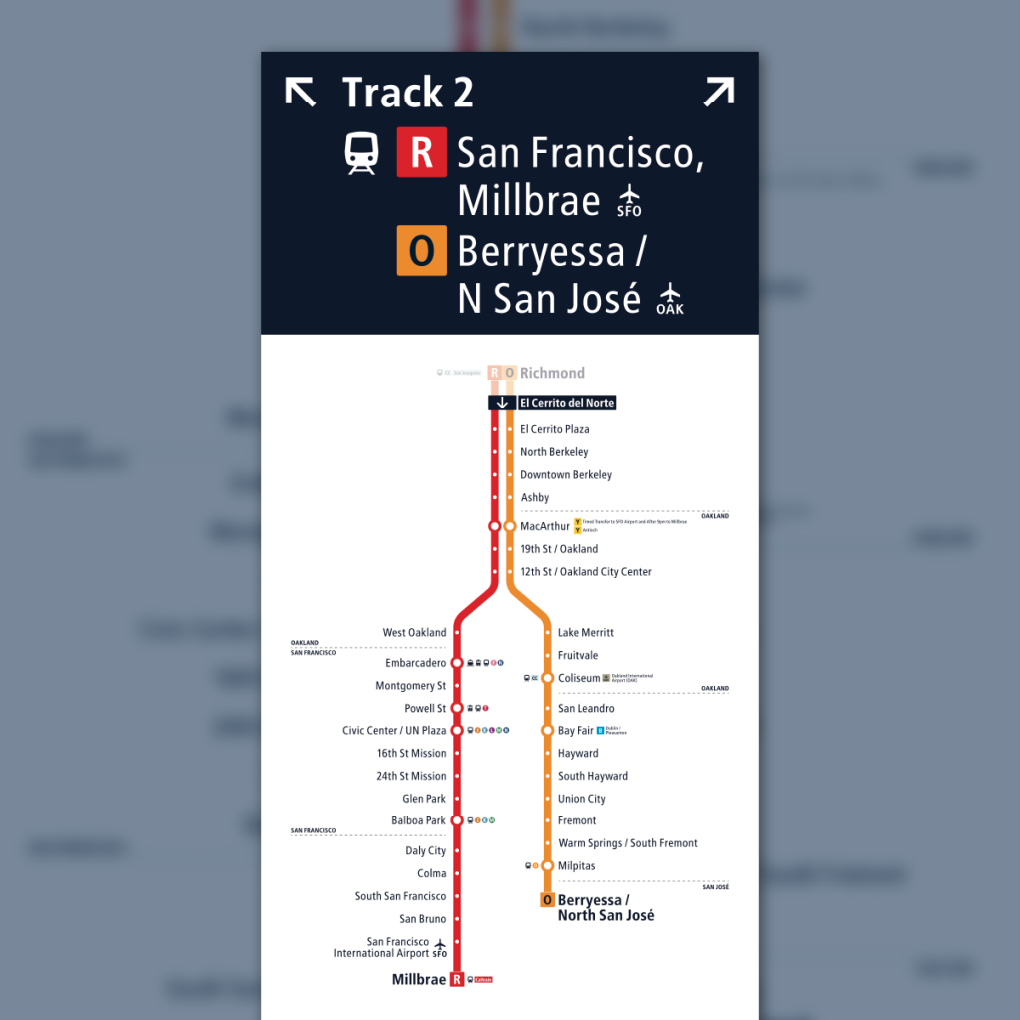
These new maps and signs — which include local transit and facility maps, diagrams, and bus stop signs — mark another step forward in Bay Area transit’s transformation into a more connected, more efficient, and more customer-focused mobility network.
Transit agency and Metropolitan Transportation Commission staff will present the designs next week at the Sept. 23 meeting of the Regional Network Management Council.
Members of the public are invited to attend the Regional Network Management meeting on Monday, Sept. 23, at 12:30 p.m. in person or online to learn more about the maps and signage, and their installation later this fall at transit hubs in El Cerrito and Santa Rosa.
Details about the meeting are available on the MTC website. This information also will be presented to the Regional Network Management Customer Advisory Group at its meeting on Tuesday, Sept. 24.
The new bus stop signs and suite of maps focuses on service frequency and uses standardized colors, line styles, and labels on maps and signs to indicate how often a bus, train or ferry arrives at a particular stop. They also show bus lines whose schedules are coordinated to provide more service.
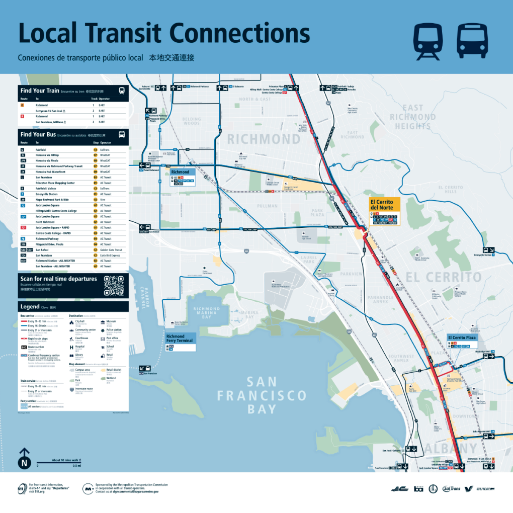
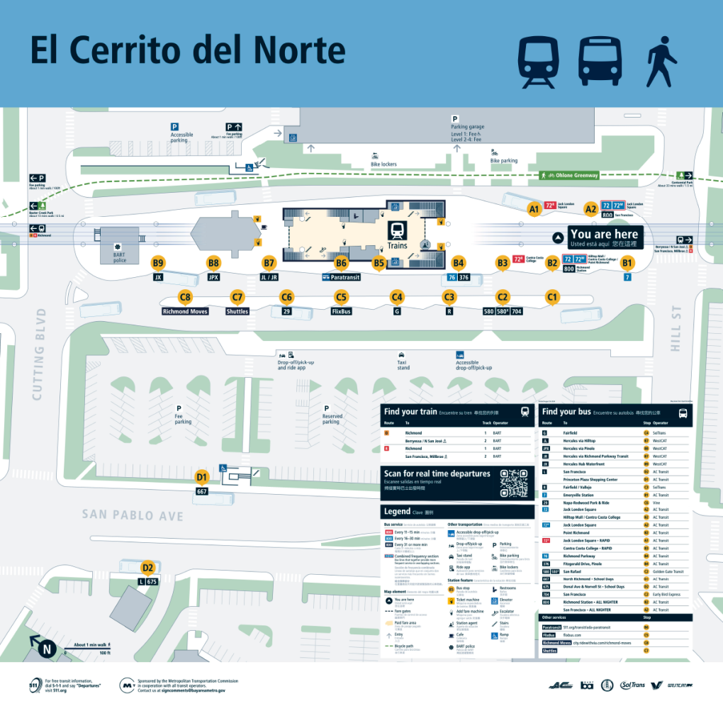
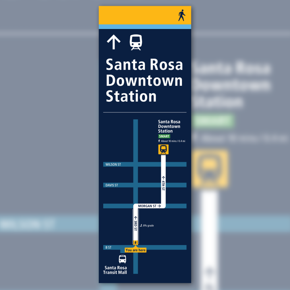
This fall MTC and its partners will invite Bay Area residents and visitors alike to share their thoughts about the newly designed transit signs and maps once they are installed at the Santa Rosa Transit Mall, the nearby Santa Rosa SMART station, and the El Cerrito del Norte BART station. A new, comprehensive regional transit map, which will enable riders to discover key destinations they can reach on the Bay Area's extensive bus, rail and ferry network, also will be released.
Riders will be able to interact with several test signs, maps and other communication materials at the Santa Rosa and El Cerrito locations and then provide comments about their experiences. The public feedback will help inform the next stage of the project, in which the new maps and wayfinding materials are expected to be installed at seven additional locations across the Bay Area in 2025 and 2026.
The new maps and signs are part of the larger Regional Mapping and Wayfinding initiative aimed at making it easier to ride transit in the Bay Area. Whether a rider is traveling by bus, rail, ferry or a combination, the signs, maps, screens and other communication systems will be consistent and easy to identify across all nine Bay Area counties.
The Regional Mapping and Wayfinding Project is the result of a first-of-its-kind effort, led by MTC with the partnership of transit riders, Bay Area cities and counties, and all 27 Bay Area transit agencies, to develop a common set of signs and maps to be used across all transit locations, from individual bus stops to major hubs where multiple systems connect. This project is just one piece of a broader effort, outlined by the Bay Area Transit Transformation Action Plan, focused on making Bay Area transit easier and more convenient for riders of all ages and abilities to use.
The Regional Network Management Council includes top executives from MTC, the San Francisco Municipal Transportation Agency, BART, AC Transit, the Santa Clara Valley Transportation Authority (VTA), Caltrain, SamTrans and the Golden Gate Bridge, Highway and Transportation District as well as three general managers representing all other transit agencies serving Bay Area communities.
MTC is the transportation planning, financing and coordinating agency for the nine-county San Francisco Bay Area.